Recap: State of the Data 2026 - Sub-national Location Event
As part of IATI’s State of the Data 2026 series, the IATI Secretariat convened a community webinar this week to explore how and why sub-national location data matters for transparency, coordination, and effective use of development and humanitarian data.
Why sub-national location data matters for IATI
The IATI Standard enables publishers to include detailed geographic information at the sub-national level. A range of data can be published about the location of any development or humanitarian activity, such as:
- administrative areas (for example, districts or regions),
- named places (such as towns or villages), or
- precise locations (including buildings or specific plots of land).
To date, nearly 500 organisations publish over 600,000 locations across around 250,000 activities. This reflects the growing availability of location data within IATI, while also raising important questions about how consistently this data is published and how effectively it is used.
Opening the webinar, Cody Wallace, Policy and Governance Specialist at the IATI Secretariat, provided an overview of the State of the Data series to date. He explained that it aims to examine specific elements of IATI data to understand publishing practices better and support improvements in data quality and usability.
Cody also emphasised that data quality should be understood in relation to how data is used—to support accountability, coordination, and decision-making.
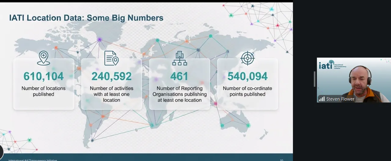
Steven Flower (IATI Secretariat / Open Data Services) shared an overview of current publication patterns. While the volume of reported location data is significant, around 21% of IATI activities currently include location information, and published locations tend to cluster in capital cities or the centre point of a country. These trends underscore the importance of strengthening sub-national data to better reflect where activities actually occur in practice.
Speaker insights on sub-national location data
To ground the discussion in practice, the consultation featured presentations from organisations working directly with geographic data.
Humanitarian OpenStreetMap Team (HOT)
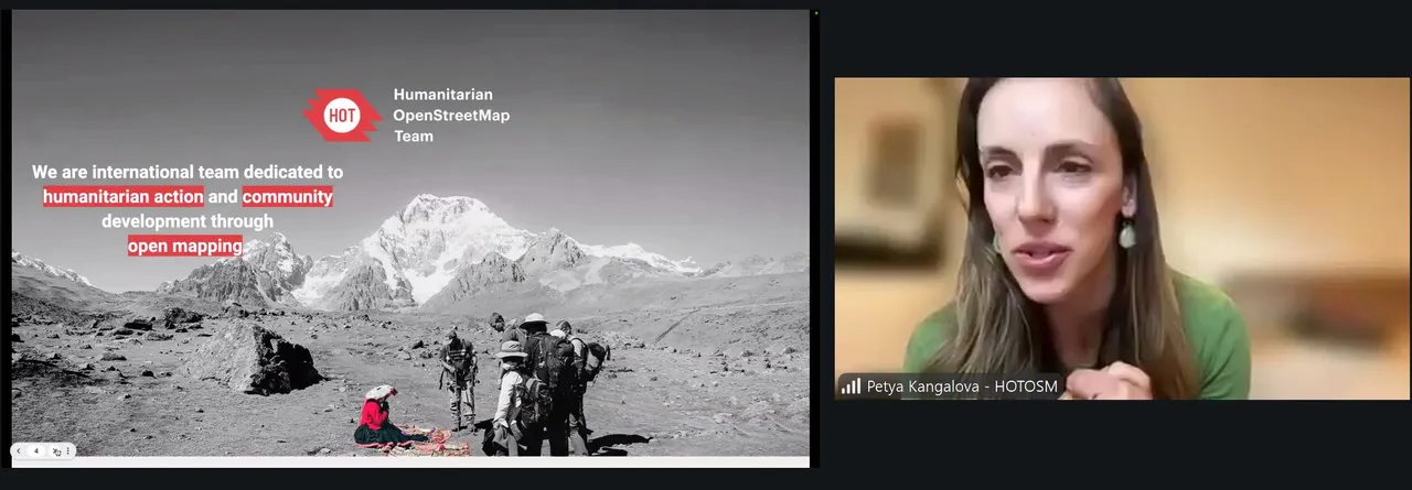
Petya Kangalova from the Humanitarian OpenStreetMap Team introduced OpenStreetMap as a global, open-source platform built through local and volunteer contributions. She outlined HOT’s long-standing work supporting humanitarian action and development through community-driven mapping.
She emphasised the importance of locally sourced geographic data, noting that
“The people who know the place best are the ones who live there.”
Petya shared examples of how OpenStreetMap data has been used in humanitarian and development contexts, including post-earthquake mapping in Türkiye and Syria and supporting census data collection in Zambia. She highlighted the importance of locally sourced and accurate geographic data for decision-making and noted the potential for combining open mapping data with IATI-published activity data in specific country contexts.
MAPME Initiative
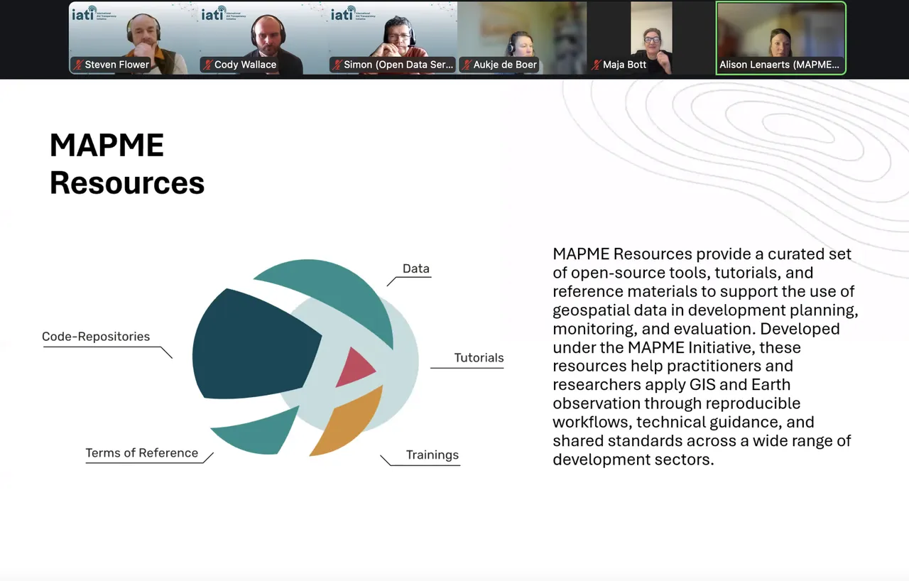
Alison Lenaerts, Maja Bott, and Johannes Schielein presented work from the MAPME Initiative, which focuses on strengthening the use of Earth observation and GIS tools across development organisations.
Alison highlighted a real-world example from Madagascar, where MAPME supported work that combined location data with satellite imagery and socio-economic information to assess how protected areas affected forests, fire incidence, and local livelihoods. This approach helped show how financing, governance, and management choices influenced results over time, and how location data can be used to generate evidence for conservation policy.
Alison set out a core challenge: while the use of project location data is growing, organisations still collect and structure this information in different ways, making it difficult to compare, analyse, and reuse data across the development sector.
“There is no standard way of collecting and modelling project location data across organisations.”
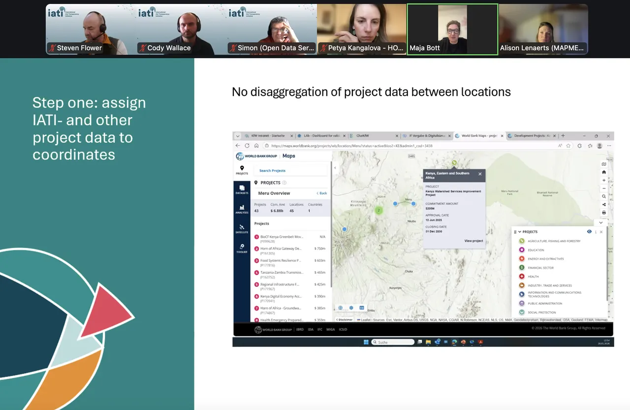
In response, MAPME presented a practical, step-by-step model showing how the IATI Standard can be used as a shared and flexible foundation for working with project location data. Maja Bott explained that a location is not only a set of coordinates in the form of points, lines or polygons, but the “combination of these coordinates with other attributes like exactness, activity status or location types – i.e. location-specific metadata”. She said a minimum viable standard could be set that organisations could realistically adopt.
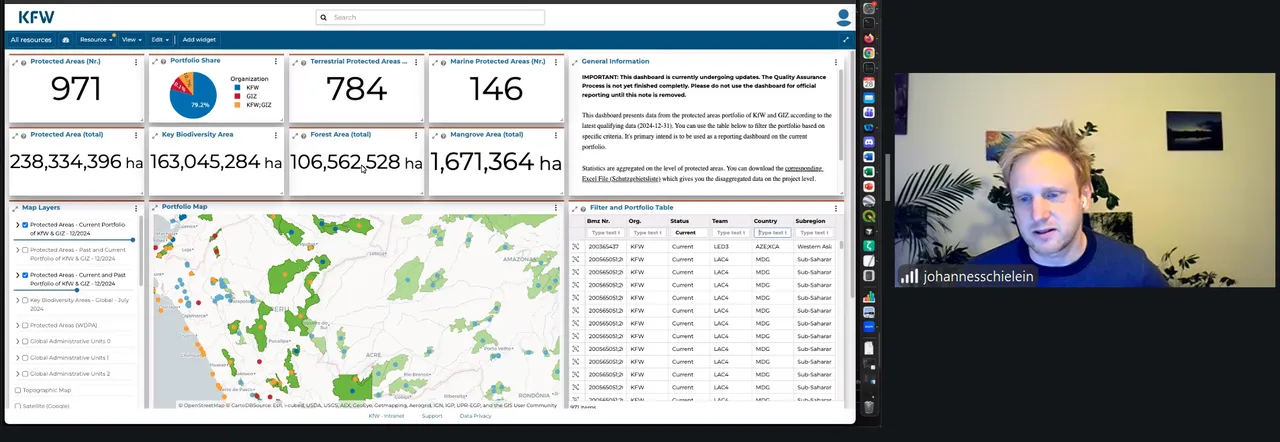
Johannes Schielein underlined the analytical value of improved location data, explaining how more detailed geographic information can support reporting, planning, and cross-dataset analysis, particularly when aligned with existing standards such as IATI. As he reflected:
“Greater alignment supports interoperability across datasets, reduces duplication of effort, and helps ensure that published data can be more easily reused by different audiences.”
Watch What Happened During the Event👇
What this means for the IATI Community
The discussion highlighted that sub-national location data has significant potential to improve the usefulness of IATI data, particularly for planning, coordination, monitoring, and evaluation at country and local levels.
Improving sub-national location data goes beyond improving just IATI data. Rich geographic data already exists across the development sector—generated by dedicated GIS professionals, open mapping communities, and local contributors. The key challenge is how these datasets can be connected and made interoperable to generate better insights for coordination, planning, and decision-making.
To address this, continued engagement between the IATI Community and geospatial and data initiatives across the technical and policy system will be essential to strengthen interoperability, aligning standards where possible, and promoting IATI data within a wider network of users and tools.
Coming up
This event was the first of IATI’s State of the Data 2026 series on sub-national Location data. IATI would like to thank all speakers and participants for their practical insights and contributions. This session took place ahead of the release of IATI’s forthcoming analysis of the location element, provided an open space for the IATI Community to share experiences, use cases, and perspectives on sub-national geography—both within and beyond IATI contexts.
Slides: State of the Data 2026 - Subnational Location Consultation